Location Insights

Explore locations with data-driven insights for risk management.

A hand holds a smartphone displaying a map application. The map shows various locations marked with icons. The screen also has a search bar with the prompt 'Where would you like to go?' and an illustration of a driver and a car at the bottom.
Risk Intelligence

Empowering decisions through intelligent location risk management.

A person is holding a map or floor plan in one hand and a smartphone in the other while standing near a railing. The background appears to feature stairs or an escalator.
Geocoding Solutions

Precise geocoding enhances your risk assessment processes seamlessly.

A smartphone rests face-up on a metal and stone surface displaying a compass app with the reading 352 degrees North. Etched inscriptions on the stone list various city names and their longitudinal coordinates, including Rome, Istanbul, Beijing, Athens, and Seoul.
A smartphone displaying a satellite view of a large body of water is placed on an old, detailed map. The phone screen shows a map application with various measurements and geographical details. The map beneath appears to be historical, with intricate street layouts and labels.
Natural Risks

Comprehensive information ensures informed decision-making for businesses.

Portfolio Management

Optimizing exposure through intelligent risk portfolio management strategies.

Insights

A smartphone with a black case lies on a light-colored surface. The phone screen displays an air quality application with information about different locations. The top section shows the air quality in Caringin, West Java with 'Unhealthy' status and a temperature of 31.0°C. Below that, information for Paris, France shows a status of 'Very Unhealthy' with a temperature of 19.0°C. There is also an advertisement banner at the bottom of the screen.
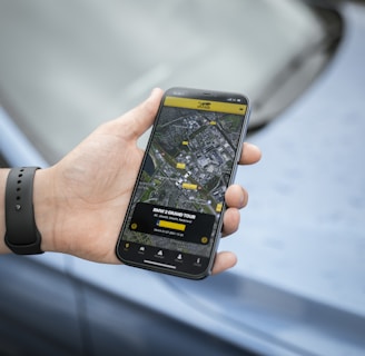
A hand holds a smartphone displaying a map and navigation interface, with points of interest highlighted. The phone is held by someone wearing a dark wristband. In the background, there is a blurred view of a car surface.
Two people are sitting at a wooden table, engaging in a discussion. A laptop is open, displaying a statistical dashboard with charts and a world map. Several smartphones and notepads are scattered on the table. The focus is on the person's hand gesturing in conversation, indicating active engagement.
A coastal landscape featuring a large yellow warning sign in the foreground. The sign alerts about the dangers of rockfalls and warns of the serious risk of injury or death, advising people to stay away from the cliffs. The background includes a sandy beach with scattered rocks, a few people walking near the shoreline, and cliffs alongside the sea.
A digital map highlighting various countries in Europe and Africa with red dots indicating specific points of interest. The map is dark-themed with bright red markers concentrated around major cities.
A warning sign is prominently displayed by a glacial lake surrounded by rocky terrain and distant hills. The sign reads 'Danger' and provides warnings about the hazards of unstable icebergs and cold water, highlighting the extreme caution needed in the area. The lake has small icebergs floating on the surface, and the surrounding landscape is rugged and sparsely vegetated.

Unlock data-driven decisions with AI-powered location intelligence solutions.